
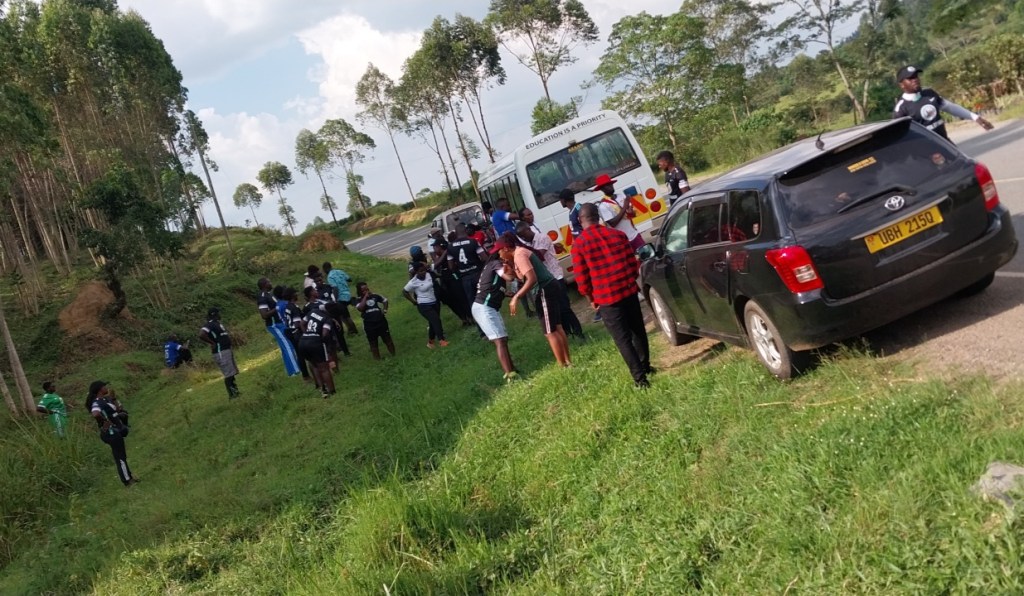
All the way from Tooro, we recently took an adventure to Ibanda area of greater Ankole Kingdom. We were in a group travelers from Fort Portal City Walkers and were hosted by another team of Nature culture lovers of the Ibanda Hill Trekkers.
We set the journey from Fort Portal with the excitement coursing through veins which was akin to a symphony, each beat promising an adventure that would forever be etched in one’s memory. It was a weekend of adventure and according to many it became a weekend to remember due to a number of nature and cultural experiences that were encountered. Travel and adventure is about creating an experience and a trip to Ibanda is indeed an experience of a life time.
Nyakahondogoro caves; Enter the mystical world of The Bachwezi, the demigods who ruled the largest traditional kingdom in Africa.
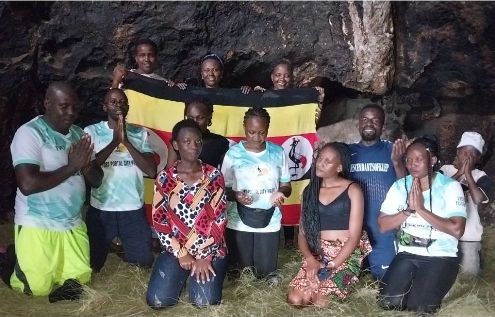
The caves are the longest and largest in Western Uganda. A hike takes you back in time and the caves, which can accomodate more than one hundered (100) people are a spectacle. Legends say that the Bachwezi “disappeared”. The caves are the most popular remaining evidence that the Bachwezi ever existed. Where they came from and where they went is all a mystery. But Natives of Ankole who visit this place for spiritual purposes will assure you that Bacwezi still exist and are interacting with people as messengers of God. In Ankole the Bacwezi are referred to as “Bakama Bénsi” literally meaning the owners of the earth. They are also refrerred to as “Ba Maraika” meaning God’s angels.
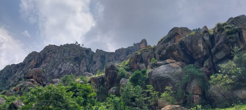
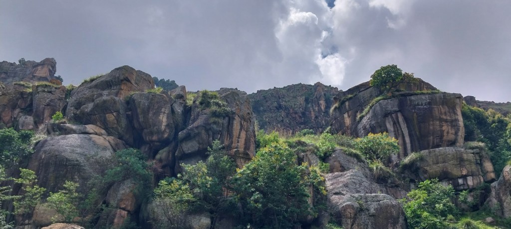
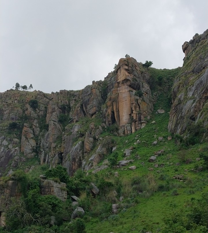
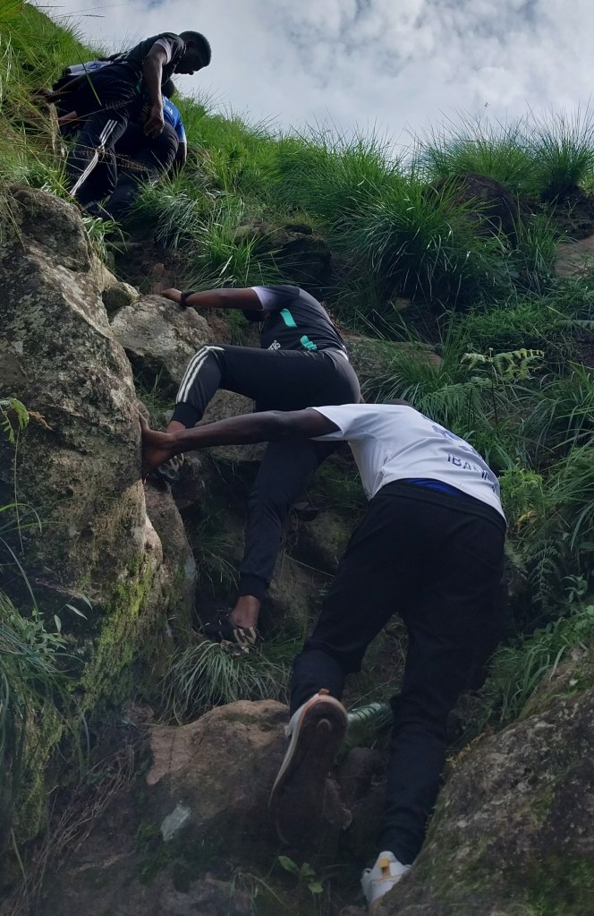
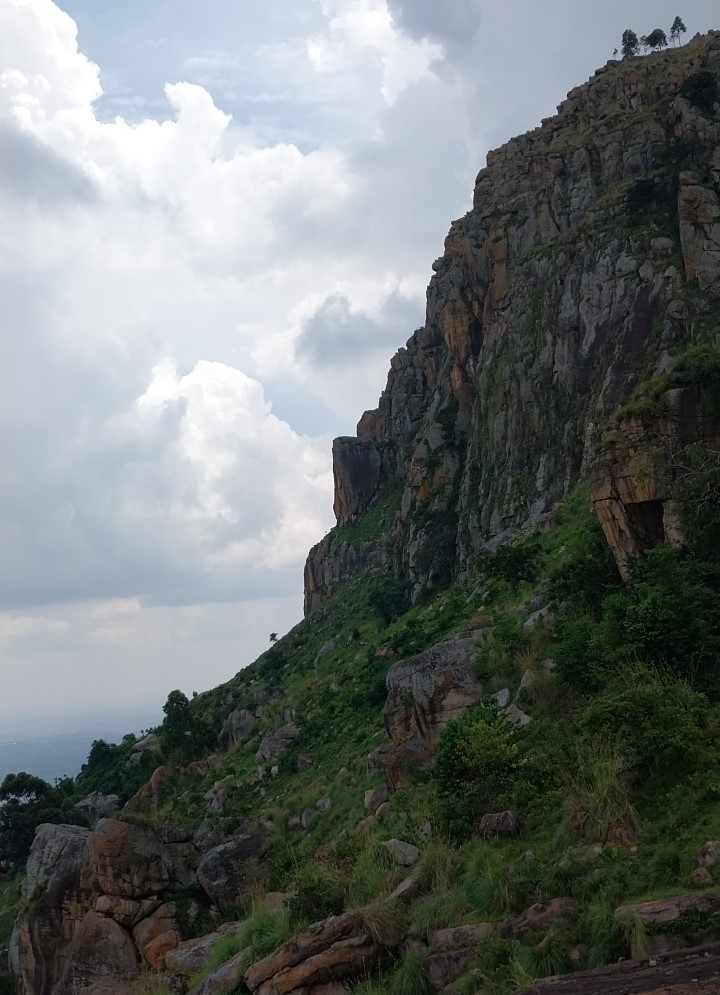
The Hike to Nyakahondogoro; Reaching to Nyakahondogoro Caves is a Mega Hike Challenge for adventure travelers who visit this area. Nyakahondogoro caves are located on top of Mabanga Hill in Ibanda district of Western Uganda famously known as Kitara Region.
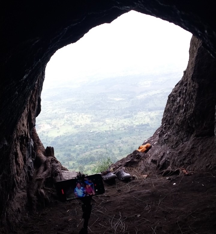
The hike up Mabanga Hill starts at Nyamirima village a few kilometers from Ibanda town in the highway to Mbarara and takes you through hills, gardens and homesteads right up to Nyakahondogoro caves with a brief but steep ascent to the top of Mabanga hill. From here, you are able to take in 360-degree views of the surrounding landscape before descending back to the main road. The caves encountered along the way can accommodate more than 100 people and are a spectacle for their sheer size.
Located in Ibanda District of Ankole Region, the caves are a potential huge income-generating site for the local tourism industry. Most importantly for the locals, they are a holy site for believers, and allegedly home to the Bachwezi demigods; Travellers visit this place for both adventure and religious tourism

Tracing the spirits of the lost Bachwezi tribe; To the local populations of Ankole, this cave is a holy site for believers, some of whom are led by a woman called Nyamunyonyi. They come to make sacrifices to and to seek for blessings from their gods. The locals believe this site to be the home of the Bachwezi, the founders of the ancient Empire of Kitara. It’s incredibly difficult to talk to a local for longer than 5 minutes without hearing a word or two about these demigods who it is believed live among them to this day. They are said to announce their presence through night sightings of fires that cover the numerous hills surrounding Ibanda.
We hiked the hill to the top, we entered different rooms of the caves, we participated in prayers inside of the caves, we had good views of the world from the top of the hill. We saw a stone that contains a cross-shaped bulb which can only be seen at specific points on the trail. According to the locals, no one has ever reached at this stone as it is located at a difficult place to reach. They told us that the bulb enlarges at night and produces light in the place.

As a visitor to this hill, you may win yourself a beating by relaying anthropological studies that show that the Bachwezi have never disappeared in thin air and are indeed still resident among us mere mortals but not as demigods but as black people who, like the Bantu, migrated south from Egypt following the liquidation of the Egyptian kingdom and subsequent amalgamation into the Persian empire around 525 BC when Cambyses, the King of Persia took it upon himself to kill the black natives. Whatever the truth may be is entirely dependent on how much one wants to believe in the existence of people flying on brooms and hills burning with no actual fire insight.
Nyakahondogoro caves is one of the biggest caves in western Uganda that is still less visited and unknown to many Travellers. According to the locals, they believe it is the source of super healing powers and that all the Bachwezi in the world came from this cave and later split to other parts of world.
Stories say that inside the caves sometimes you will be able to see a young girl who grew up in the same cave, and it’s where she stays. It’s said she is one of the Bachwezi daughters and that she possesses natural super healing powers and people always gather around her to pray and get healed every Wednesday and Friday Night. That she has powers to see whoever is coming towards and inside the cave even when she’s not near the entrance to the cave because the cave is too big as it covers both Ibanda district and Buhweju District.

It’s also said she can interact with you in all languages minus English because Bachwezi denied her to speak it. When you visit the cave in her access, she will take you through all rooms inside the cave while explaining why the cave has a lot of rooms among them being the dining room where the Bachwezi used to gather and eat dinner, Meeting room where all Bachwezi in the world still gather to share natural powers, the healing room, the blessing room, etc. The most accessible areas are the meeting room and the prayer room. Many of the rooms are pretty well-hidden in the landscape. One of the best ways to stumble across those hidden cave rooms in Ibanda is to head out on a scenic hike. Some are so well-hidden, however, that you’ll need to pay close attention to where you traveling.
In the dining room you will be able to find Millet baskets, meat sauce in well-designed bowels and it’s believed that if you try to eat one of those meals inside the cave, you will remain there or you die immediately or you will never speak again.
When you follow through the caves, you will get a chance to reach Mukazi-anyaara falls locked in Mugarama hills in Buhweju. It’s called Mukazi-Anyaara (sounding funny) meaning “a woman that sprashes” because of the way water splashes out of a stone the same way women do while urinating and having sex (according to locals)
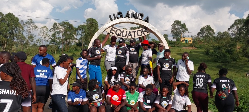
Moments at Equator Line in Ibanda
On the same trip we visited the Equator Line in Ibanda District, a rare opportunity on planet earth. One of the few humanly accessible locations in the world is to experience the Equator line phenomenon. Many travellers plan their travels in a way that leads to such an experience, and Ibanda District is now a desired tourism destination because of this equator point.
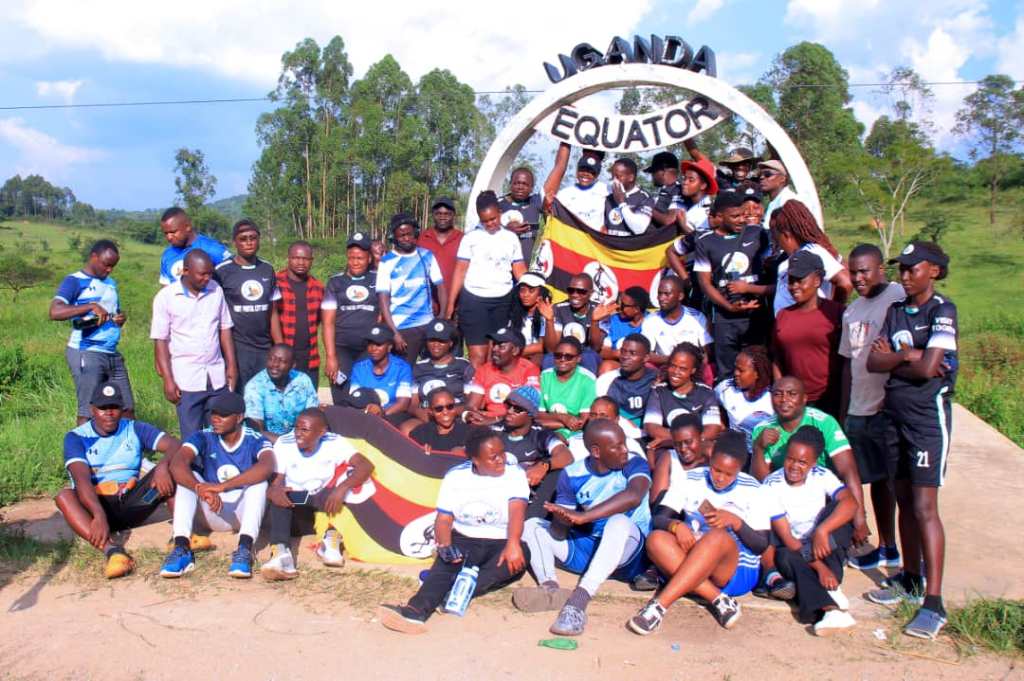
Located 14km North of Ibanda town in Bisheshe Division, Equator line is a place of geographical attraction that many travellers come to experience the equatorial bulge.
What is an Equator? An equator is an imaginary line around the middle of a planet or other celestial body. It is halfway between the north pole and the south pole, at 0 degrees latitude. An equator divides the planet into a northern hemisphere and a southern hemisphere.
The position of this particular Equator is between two major towns in the district, Ibanda town in the Southern hemisphere and Ishongororo town in the northern hemisphere.
Earth is widest at its Equator. The distance around Earth at the Equator, its circumference, is 40,075 kilometers (24,901 miles).
Earth’s diameter is also wider at the Equator, creating a phenomenon called an equatorial bulge. The diameter of a circle is measured by a straight line that passes through the center of the circle and has its endpoints on the boundary of that circle. Scientists can calculate the diameter of latitudes, such as the Equator and Arctic Circle.
Earth’s diameter at the Equator is about 12,756 kilometers (7,926 miles). At the poles, the diameter is about 12,714 kilometers (7,900 miles). Earth’s equatorial bulge is about 43 kilometers (27 miles).
The equatorial bulge means that people standing at sea level near the poles are closer to the center of Earth than people standing at sea level near the Equator. The equatorial bulge affects the ocean, too—sea levels are slightly higher in equatorial regions than near the poles.
Lessons to learn from a visit to Equator line:
Equatorial Bulge; The equatorial bulge is created by Earth’s rotation. As lines of latitude increase in size, a point has to travel faster to complete a circle (revolution) in the same amount of time. The rotational speed, or spin, at the Arctic Circle is slower than the spin at the Tropic of Cancer, because the circumference of the Arctic Circle is much smaller and a point doesn’t have to travel as far to complete a revolution. The spin at the Tropic of Cancer is much slower than the spin at the Equator. Near the poles, Earth’s rotational speed, or spin, is near zero. At the Equator, the spin is about 1,670 kilometers per hour (1,038 miles per hour). Earth’s gravitational pull is slightly weaker at the Equator due to its equatorial bulge.
The slightly weaker gravitational pull and momentum of spinning Earth makes equatorial regions ideal places for space launches. It takes an enormous amount of energy to launch a satellite or other spacecraft out of Earth’s atmosphere. It takes less energy (rocket fuel) to launch in lower gravity. It also takes less energy to launch when spinning Earth is already giving the satellite a push of 1,670 kilometers per hour (1,038 miles per hour).
The United States launches most spacecraft from the Kennedy Space Center in southern Florida, which is almost as close to the Equator as possible in the continental U.S. Other rocket-launching facilities near the Equator include Shaba North, Democratic Republic of Congo, and Gan Island, Maldives.
Recently, mobile launch platforms, such as Ocean Odyssey, have successfully launched satellites into orbit from the equatorial Pacific Ocean.
Equatorial Climates
Twice a year, during the spring and autumn equinoxes, the sun passes directly over the Equator. Even during the rest of the year, equatorial regions often experience a hot climate with little seasonal variation.
As a result, many equatorial cultures recognize two seasons—wet and dry. The wet, or rainy, season often lasts most of the year. The long, warm, rainy season creates tropical rainforests. Some of the most expansive rainforests in the world are in equatorial regions: the Amazon rainforest of South America, the Congo rainforest of Central Africa, and the varied Southeast Asian rainforest stretching from India to Vietnam.
Humid weather means that equatorial regions are not the hottest in the world, even though they are among the closest to the sun. The water in the equatorial air cools it slightly.
Many cultures thrive in warm equatorial regions. The Fang people of Gabon, for instance, are successful farmers who take advantage of the warm temperature and long rainy season to cultivate crops such as corn, yams, and plantains. The Fang also raise livestock that have adapted to the climate, such as goats and chickens.
Not all equatorial regions are hot and humid, however. Mount Kilimanjaro, Tanzania, is only 330 kilometers (205 miles) from the Equator, but its elevation creates a climate with cool, dry weather and even alpine glaciers.
The Andes are another equatorial region lacking the hot, humid climate often associated with the Equator. The mountain range includes a desert with almost no rain (the Atacama), as well as some of the tallest peaks on Earth. Here, too, cultures have thrived for thousands of years. The Aymara people of the Altiplano of Bolivia, Peru, and Chile, are primarily an urban people who identify strongly with the innovative navigational successes of their ancestors. In the 20th century, the Aymara helped build railroads through the high, equatorial Andes.
Many plant and animal species thrive in equatorial climates. The Amazon and Congo rain forest ecosystems, for example, are amazingly rich in biodiversity. A single hectare (2.47 acres) of rainforest in Brazil may contain 750 species of trees and twice that many species of insects. The equatorial savanna of Kenya includes mammals such as lions (Panthera leo), cheetahs (Acinonyx jubatus), and elephants. The chilly equatorial Andes are famous for its camelid species: llamas (Lama glama), alpacas (Lama pacos), vicuñas (Vicugna vicugna), and guanacos (Lama guanicoe).
Aqua Tourism at Kiryabishoro Aqua Park
We also visited the Aqua Park, honestly speaking for most of us it was the first time to encounter the aqua park experience in life.

An Aqua Park or water park (also water world) is an amusement park that features water bodies areas such as fishing game pools, swimming pools, water slides, splash pads, water playgrounds, and lazy rivers, as well as areas for floating, bathing, swimming, and other barefoot environments. a large area containing several different pools, usually with equipment and activities for fishing, swimmers, that visitors take part in what is popularly known as Aqua tourism
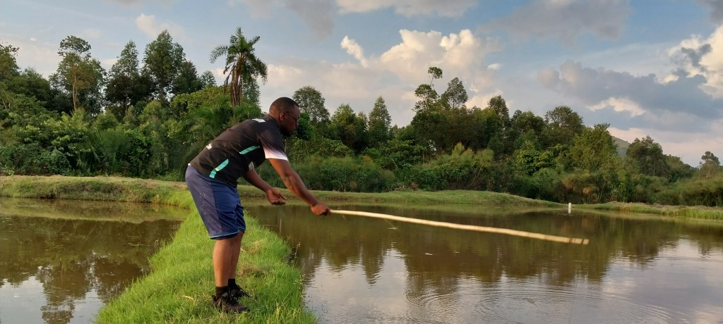
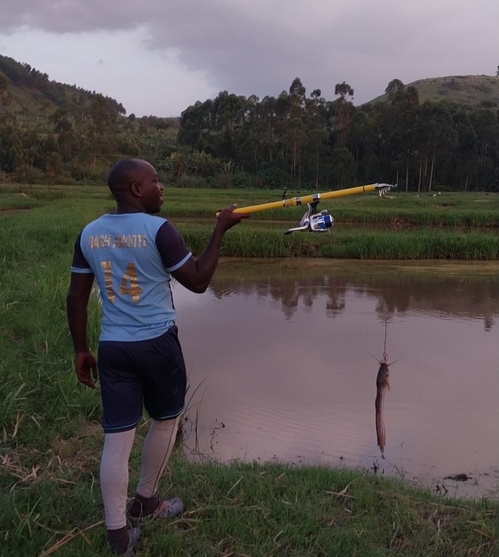
It was so exciting touring the water bodies where several water ponds are lined up being filled by a small stream water besides a huge river- River Rwambu that separates the two kingdoms of Ankole and Tooro. Remember we had come from Tooro and we were visiting Ankole.

A common rule was given to us on arrival that “Eat what you fish” meaning that everyone was going to participate in fishing and everyone would eat your catch. Fire was already made waiting for each one to roast your catch and make your lunch. Of course we were all hungry as we had come from the hike in Mabanga hills. We followed the rules and it was interesting fishing for the first time, many of us had never eaten fish caught by ourselves.

Whether you like to travel and see the world as a holiday tourist, a working tourist, a historical student or a research tourist, whatever your reason for travelling to other lands far and near, Kiryabishoro Aqua Park should be on your next agenda for travel in the beautiful Uganda. Once you get here, you will either fall in love with food, people, culture, beautiful destinations, working environment, and wish to start business here.
Close your eyes and imagine being here for excursion, breathtaking views of this beautiful Fishponds and the surrounding community, sights and sounds and the entire Aqua park at your fingertips.
This is a little of what you can enjoy in this area of Kaarokarungi, not forgetting that we were among the Banyankole as our hosts, one of the most rich and hospitable cultures in Africa.
Read more about Banyankole and Ankole Culture https://kitararcc.com/the-banyankole/
Read more about Batooro and Tooro Culture https://kitararcc.com/batooro-people/
